
Course Information
Course Name: Educational Technology and Microteaching
Course Code: EDE 5301
Programme: Bachelor of Education with Honours in History and Geography
Academic Year: 2024–2025
Course Lecturer:
Credits: 10
Level/Semester: Year III, Trimestre III
Delivery Mode: Face-to-face lectures, technology-based learning activities, microteaching sessions, teaching demonstrations, classroom simulations, group discussions, seminars, practical exercises, and Moodle-supported learning.
Welcome Message
Welcome to Educational Technology and Microteaching.
This course introduces students to the integration of technology in education and the development of effective teaching skills through microteaching practices. It focuses on preparing future educators to use modern instructional approaches and digital tools to enhance teaching and learning.
Throughout the course, students will explore educational technologies, instructional materials, lesson planning, teaching techniques, classroom communication, and practical teaching demonstrations. The course provides opportunities for students to practice teaching skills, receive feedback, and improve their professional competencies.
Course Overview
The Educational Technology and Microteaching course provides students with theoretical knowledge and practical skills required for effective technology-supported teaching. It examines the role of educational technologies in improving classroom instruction and promoting learner-centered education.
Students will study instructional media, digital learning resources, Learning Management Systems (LMS), multimedia teaching tools, online learning platforms, and methods of integrating ICT into classroom activities.
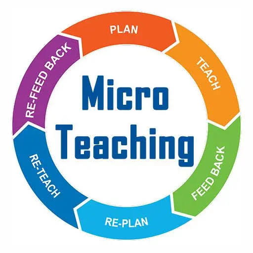
The course also emphasizes microteaching as a practical approach to developing teaching competencies. Students will practice lesson preparation, presentation skills, questioning techniques, classroom management, assessment methods, and reflective teaching through simulated classroom experiences.
By the end of the course, students will be able to design effective lessons, integrate appropriate technologies, and demonstrate professional teaching skills.
Learning Objectives
By the end of the course, students should be able to:
- Understand concepts and principles of educational technology.
- Explain the importance of technology in modern education.
- Identify and use appropriate instructional technologies.
- Design technology-supported teaching and learning activities.
- Understand the principles and processes of microteaching.
- Develop effective lesson plans and teaching materials.
- Demonstrate classroom teaching skills through microteaching.
- Apply effective communication and classroom management techniques.
- Use assessment and feedback to improve teaching performance.
- Promote innovative and learner-centered teaching practices.
Learning Outcomes
Upon successful completion of this course, students will be able to:
- Explain the role of educational technology in teaching and learning.
- Select suitable digital tools and instructional resources.
- Prepare technology-supported lesson materials.
- Apply ICT tools to enhance classroom instruction.
- Demonstrate effective teaching skills through microteaching sessions.
- Apply appropriate teaching methods and classroom management strategies.
- Evaluate teaching performance using feedback.
- Develop professional confidence in classroom presentation.
- Integrate technology into different teaching contexts.
- Demonstrate competence as modern technology-supported educators.
Learning Resources
- Lecturer's notes and presentations
- Educational Technology textbooks
- Microteaching and teaching methodology books
- Instructional design resources
- Digital learning platforms and online resources
- Learning Management Systems (LMS) materials
- Multimedia teaching tools
- Educational videos and tutorials
- Curriculum and teacher training guidelines
- Moodle learning materials
Learning Activities
- Interactive lectures
- Lesson planning exercises
- Microteaching demonstrations
- Peer teaching and feedback sessions
- Development of digital teaching materials
- Classroom simulation activities
- Group discussions
- Student presentations
- Research assignments
- Individual and group projects
- Moodle-based learning activities
Assessment Methods
- Assignment: 10 Marks
- Continuous Assessment Test (CAT): 10 Marks
- Microteaching Practical: 40 Marks
- Final Examination: 40 Marks
Course Duration
15 Weeks
- Teacher: Edison ISHIMWE
Course Information
Course Name: Applied Remote Sensing and Geographical Information System (GIS)
Course Code: GEO 4103
Programme: Bachelor of Education with Honours in History and Geography
Academic Year: 2024–2025
Course Lecturer:
Credits: 10
Level/Semester: Year III, Trimestre III
Delivery Mode: Face-to-face lectures, GIS laboratory practicals, remote sensing exercises, computer-based analysis, field data collection, spatial mapping activities, case studies, research assignments, and Moodle-supported learning.
Welcome Message
Welcome to Applied Remote Sensing and Geographical Information System (GIS).
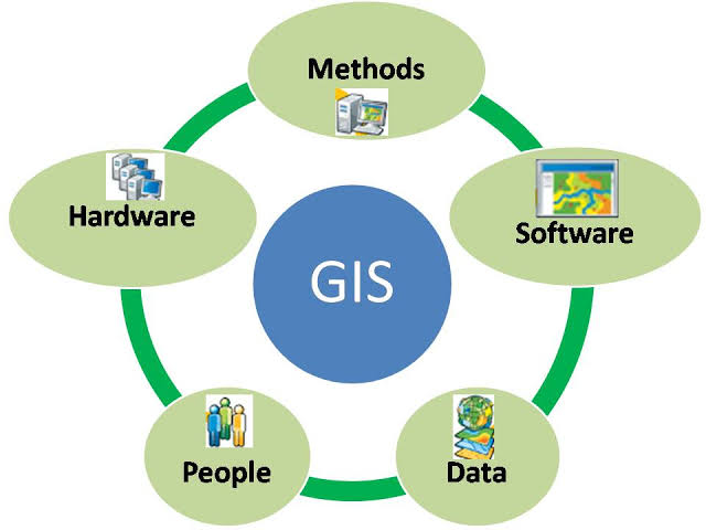
This course introduces students to the practical applications of remote sensing and Geographic Information Systems in collecting, analyzing, interpreting, and presenting geographical information.
Throughout the course, students will explore satellite imagery, aerial photographs, spatial data analysis, digital mapping, GIS applications, and geospatial technologies used in environmental management, resource assessment, urban planning, and geographical research. The course equips future geography educators with practical skills to apply modern technologies in understanding and solving spatial problems.
Course Overview
The Applied Remote Sensing and Geographical Information System (GIS) course provides students with practical knowledge and skills in the use of geospatial technologies for analyzing geographic phenomena. It focuses on the integration of remote sensing data with GIS tools to support geographical analysis and decision-making.
Students will study principles of remote sensing, satellite image interpretation, image processing techniques, spatial data acquisition, GIS database management, mapping methods, and spatial analysis applications.
The course examines the use of GIS and remote sensing in areas such as environmental monitoring, land-use mapping, agriculture, natural resource management, disaster assessment, urban development, and climate studies.
Through laboratory practicals and field exercises, students will develop the ability to collect, process, analyze, and visualize spatial information using geospatial technologies.
By the end of the course, students will be able to apply remote sensing and GIS techniques in geographical research, teaching, and environmental planning.
Learning Objectives
By the end of the course, students should be able to:
- Understand principles and concepts of remote sensing and GIS.
- Explain the relationship between remote sensing and geographical analysis.
- Identify sources and types of spatial data.
- Interpret satellite images and aerial photographs.
- Apply GIS techniques in spatial data management.
- Use GIS software for mapping and spatial analysis.
- Perform basic image interpretation and classification.
- Integrate remote sensing data into GIS projects.
- Apply geospatial technologies to environmental and development issues.
- Develop practical skills in geospatial problem-solving.
Learning Outcomes
Upon successful completion of this course, students will be able to:
- Explain fundamental concepts of remote sensing and GIS.
- Interpret satellite images and aerial photographs.
- Collect, manage, and analyze spatial data.
- Produce digital maps using GIS software.
- Apply remote sensing techniques in environmental studies.
- Perform basic spatial analysis and visualization.
- Integrate GPS, GIS, and remote sensing data.
- Analyze land-use and environmental changes using geospatial tools.
- Apply GIS techniques in geographical research and planning.
- Demonstrate competence in modern geospatial technologies.
Learning Resources
- Lecturer's notes and presentations
- Remote Sensing and GIS textbooks
- GIS software manuals (QGIS, ArcGIS)
- Satellite imagery and aerial photographs
- Digital maps and spatial databases
- GPS data collection tools
- Remote sensing image processing materials
- Academic journals in GIS and Geoinformatics
- Environmental and land-use reports
- Government geospatial resources
- Moodle learning materials
Learning Activities
- Interactive lectures
- GIS laboratory practical sessions
- Satellite image interpretation exercises
- Digital mapping activities
- Remote sensing data analysis
- GPS field data collection
- Spatial database development
- Case study analysis
- Student presentations
- Individual and group projects
- Research assignments
- Moodle-based learning activities
Assessment Methods
- Assignment: 10 Marks
- Continuous Assessment Test (CAT): 10 Marks
- Practical Project: 40 Marks
- Final Examination: 40 Marks
Course Duration
15 Weeks
- Teacher: Edison ISHIMWE
Course Information
Course Name: History of Emergent States in Africa
Course Code: HIS 4103
Programme: Bachelor of Education with Honours in History and Geography
Academic Year: 2024–2025
Course Lecturer:
Credits: 10
Level/Semester: Year III, Trimestre III
Delivery Mode: Face-to-face lectures, historical document analysis, seminars, group discussions, comparative case studies, student presentations, research assignments, and Moodle-supported learning.
Welcome Message
Welcome to History of Emergent States in Africa.
This course introduces students to the historical processes that shaped the emergence and development of modern African states after colonial rule. It explores independence movements, nation-building processes, governance systems, and the social, political, and economic challenges faced by African countries.
Throughout the course, students will examine how African states transitioned from colonial administrations to independent governments and how historical experiences continue to influence contemporary African societies. The course equips future educators with the knowledge and analytical skills needed to understand Africa’s political and historical transformation.
Course Overview
The History of Emergent States in Africa course provides students with an understanding of the formation and evolution of African states in the post-colonial period. It examines the processes of decolonization, independence struggles, state formation, political development, and socio-economic transformation.
Students will explore African nationalism, independence movements, leadership challenges, governance systems, political ideologies, economic policies, regional cooperation, conflicts, and democratization processes.
The course also examines the role of African institutions and regional organizations in promoting development, peace, and cooperation. Through comparative studies of selected African countries, students will analyze the achievements, challenges, and future prospects of African states.
By the end of the course, students will be able to critically analyze the historical development of African states and understand their impact on contemporary African affairs.
Learning Objectives
By the end of the course, students should be able to:
- Understand the historical background of emerging African states.
- Explain the processes of African decolonization and independence.
- Analyze the impact of colonial legacies on African state formation.
- Examine nationalist movements and independence struggles.
- Evaluate political, social, and economic developments in post-colonial Africa.
- Analyze challenges of governance and nation-building.
- Examine the role of African leaders and institutions.
- Understand regional cooperation and integration efforts.
- Compare development experiences of different African states.
- Develop historical research and analytical skills.
Learning Outcomes
Upon successful completion of this course, students will be able to:
- Explain the emergence of modern African states.
- Analyze the relationship between colonial history and post-independence development.
- Describe major African independence movements and their outcomes.
- Evaluate different approaches to nation-building in Africa.
- Analyze political and economic challenges affecting African states.
- Explain the role of leadership and institutions in state development.
- Compare historical experiences of different African countries.
- Interpret historical documents related to African state formation.
- Assess democratization and development processes in Africa.
- Apply historical knowledge to contemporary African issues.
Learning Resources
- Lecturer's notes and presentations
- African History textbooks
- Post-colonial Africa reference books
- Books on nationalism and independence movements
- Historical documents and archival materials
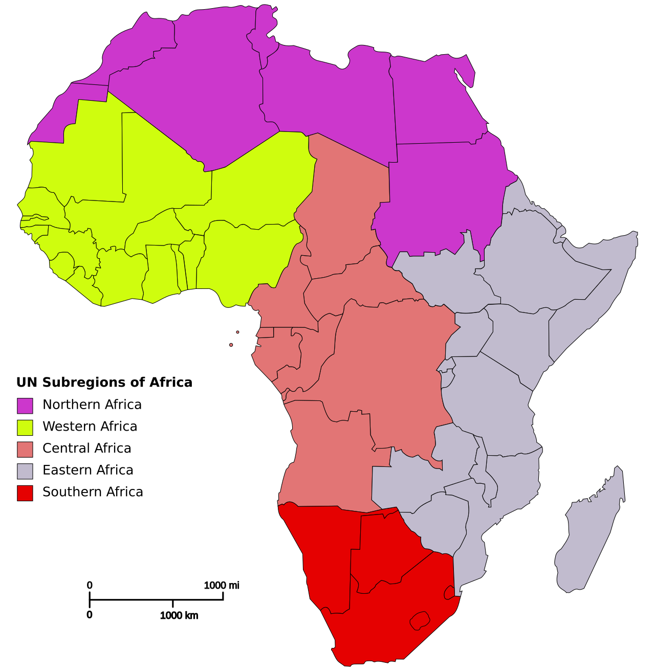
- Political maps and atlases of Africa
- Academic journals in African History and Political Studies
- African Union and regional organization publications
- Development reports and policy documents
- Educational documentaries and multimedia resources
- Moodle learning materials
Learning Activities
- Interactive lectures
- Historical document analysis
- Comparative country case studies
- Group discussions
- Student presentations
- Historical debates
- Research assignments
- Individual and group projects
- Seminar presentations
- Moodle-based learning activities
Assessment Methods
- Assignment: 10 Marks
- Continuous Assessment Test (CAT): 10 Marks
- Mid-Term Examination: 40 Marks
- Final Examination: 40 Marks
Course Duration
15 Weeks
- Teacher: Edison ISHIMWE
Course Information
Course Name: Geography of Natural Resources
Course Code: HIS 4102
Programme: Bachelor of Education with Honours in History and Geography
Academic Year: 2024–2025
Course Lecturer:
Credits: 10
Level/Semester: Year III, Trimestre III
Delivery Mode: Face-to-face lectures, fieldwork, resource mapping, environmental observations, case studies, group discussions, seminars, research assignments, and Moodle-supported learning.
Welcome Message
Welcome to Geography of Natural Resources.
This course introduces students to the geographical study of natural resources, their distribution, utilization, management, and conservation. It explores the relationship between natural resources, human activities, economic development, and environmental sustainability.
Throughout the course, students will examine different categories of resources, including land, water, forests, minerals, energy resources, wildlife, and agricultural resources. The course equips future geography educators with knowledge and practical skills to understand resource challenges and promote sustainable resource management.
Course Overview
The Geography of Natural Resources course provides students with an understanding of the spatial distribution, exploitation, management, and conservation of natural resources. It examines how geographical factors influence resource availability and how human activities affect resource sustainability.
Students will explore renewable and non-renewable resources, resource utilization patterns, environmental impacts, resource conflicts, conservation strategies, and policies related to sustainable development.
The course emphasizes practical learning through field observations, resource mapping, environmental assessments, and case studies. Students will develop skills to analyze resource-related challenges and propose appropriate management strategies.
By the end of the course, students will be able to apply geographical knowledge to understand natural resource issues and contribute to sustainable environmental management.
Learning Objectives
By the end of the course, students should be able to:
- Understand concepts and principles of natural resource geography.
- Identify and classify different types of natural resources.
- Explain the geographical distribution of natural resources.
- Analyze relationships between humans and natural resources.
- Examine methods of resource exploitation and utilization.
- Assess environmental impacts of resource use.
- Explain resource conservation and management strategies.
- Analyze challenges related to resource depletion and scarcity.
- Apply geographical tools in resource assessment and mapping.
- Promote sustainable use of natural resources.
Learning Outcomes
Upon successful completion of this course, students will be able to:
- Explain concepts related to natural resources and their geographical importance.
- Classify renewable and non-renewable resources.
- Analyze spatial patterns of resource distribution.
- Explain the role of natural resources in economic development.
- Evaluate environmental impacts caused by resource exploitation.
- Assess resource conservation approaches.
- Interpret maps and geographical data related to natural resources.
- Analyze resource management challenges.
- Apply geographical methods in resource studies.
- Demonstrate awareness of sustainable resource utilization.
Learning Resources
- Lecturer's notes and presentations
- Geography of Natural Resources textbooks
- Environmental Geography reference books
- Natural resource management materials
- Topographic maps and resource atlases
- GIS and remote sensing resources
- Government environmental and resource reports
- Academic journals in Geography and Environmental Studies
- Environmental impact assessment reports
- Educational documentaries and multimedia resources
- Moodle learning materials
Learning Activities
- Interactive lectures
- Natural resource mapping exercises
- Field observations and investigations
- Environmental case study analysis
- Group discussions
- Student presentations
- Research assignments
- Individual and group projects
- Resource management exercises
- Moodle-based learning activities
Assessment Methods
- Assignment: 10 Marks
- Continuous Assessment Test (CAT): 10 Marks
- Mid-Term Examination: 40 Marks
- Final Examination: 40 Marks
Course Duration
15 Weeks
- Teacher: Edison ISHIMWE
Course Information
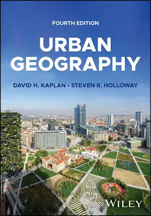
Course Name: Urban and Political Geography
Course Code: GEO 4101
Programme: Bachelor of Education with Honours in History and Geography
Academic Year: 2024–2025
Course Lecturer:
Credits: 10
Level/Semester: Year III, Trimestre III
Delivery Mode: Face-to-face lectures, fieldwork, urban studies, map interpretation, GIS applications, case studies, seminars, group discussions, research assignments, and Moodle-supported learning.
Welcome Message
Welcome to Urban and Political Geography.
This course introduces students to the geographical study of urban spaces, political territories, and the relationship between human activities, governance, and spatial organization. It explores how cities develop, how political systems influence territories, and how geographical factors shape social and political processes.
Throughout the course, students will examine urbanization, settlement patterns, urban planning, political boundaries, states, geopolitics, and contemporary urban and political challenges. The course equips future geography educators with analytical skills to understand and explain the complex interactions between space, society, and power.
Course Overview
The Urban and Political Geography course provides students with an understanding of the processes shaping urban development and political organization of geographical spaces. It examines the formation, growth, and transformation of cities as well as the influence of political decisions on territories and human activities.
Students will explore urban theories, land use patterns, urban growth, migration, housing, transportation, urban challenges, and sustainable city development. The political geography component focuses on concepts such as state, nation, territory, sovereignty, borders, electoral geography, geopolitics, and international relations.
Through field studies, spatial analysis, map interpretation, and case studies, students will develop the ability to analyze urban and political issues and apply geographical approaches to solving contemporary challenges.
Learning Objectives
By the end of the course, students should be able to:
- Understand concepts and theories of urban and political geography.
- Explain processes and patterns of urban development.
- Analyze causes and effects of urbanization.
- Examine urban planning strategies and challenges.
- Understand population movements and settlement patterns.
- Explain concepts of territory, state, nation, and sovereignty.
- Analyze geographical dimensions of political systems.
- Examine the role of boundaries and geopolitics.
- Apply geographical tools in urban and political studies.
- Develop skills in spatial and political analysis.
Learning Outcomes
Upon successful completion of this course, students will be able to:
- Explain major concepts in urban and political geography.
- Analyze patterns of urban growth and spatial organization.
- Evaluate challenges associated with urbanization.
- Interpret urban maps and geographical information.
- Assess approaches to sustainable urban development.
- Explain relationships between geography and political power.
- Analyze the importance of territories and boundaries.
- Evaluate geopolitical issues at different scales.
- Apply geographical methods in studying urban and political phenomena.
- Recommend solutions to urban and political challenges.
Learning Resources
- Lecturer's notes and presentations
- Urban Geography textbooks
- Political Geography reference books
- Urban planning and development reports
- Maps, atlases, and GIS datasets
- Remote sensing and spatial analysis materials
- Government urban development documents
- Academic journals in Geography and Urban Studies
- International development reports
- Educational documentaries and multimedia resources
- Moodle learning materials
Learning Activities
- Interactive lectures
- Urban field studies and observations
- Political geography case studies
- GIS and map interpretation exercises
- Group discussions
- Student presentations
- Research assignments
- Individual and group projects
- Seminars and debates
- Moodle-based learning activities
Assessment Methods
- Assignment: 10 Marks
- Continuous Assessment Test (CAT): 10 Marks
- Mid-Term Examination: 40 Marks
- Final Examination: 40 Marks
Course Duration
15 Weeks
- Teacher: Edison ISHIMWE
Course Information
Course Name: History of Asia
Course Code: HIS 4101
Programme: Bachelor of Education with Honours in History and Geography
Academic Year: 2024–2025
Course Lecturer:
Credits: 10
Level/Semester: Year III, Trimestre III
Delivery Mode: Face-to-face lectures, historical document analysis, map interpretation, case studies, seminars, group discussions, research assignments, student presentations, and Moodle-supported learning.
Welcome Message
Welcome to History of Asia.
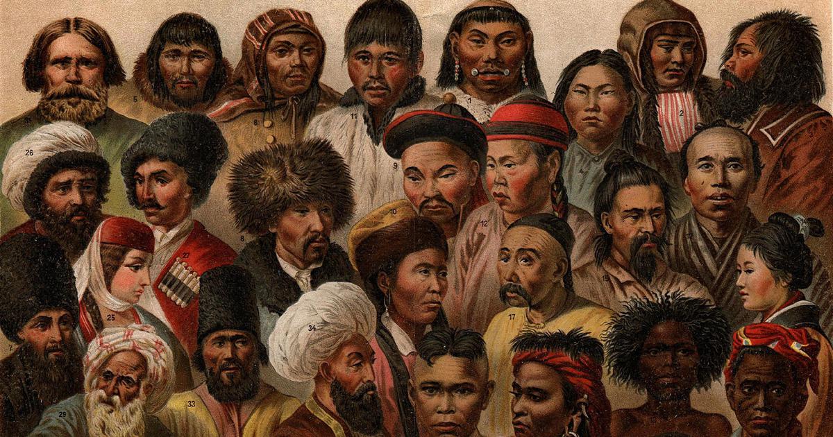
This course introduces students to the historical development of Asian societies, civilizations, political systems, cultures, and economic transformations. It explores the major events and processes that shaped Asia from ancient times to the modern era.
Throughout the course, students will examine Asian civilizations, imperial systems, religious and cultural developments, colonial experiences, independence movements, modernization, and contemporary political and economic changes. The course equips future educators with historical knowledge and analytical skills necessary for understanding Asia’s role in world history.
Course Overview
The History of Asia course provides students with a comprehensive understanding of the historical evolution of Asian societies and their contributions to global civilization. It examines major Asian regions, including East Asia, South Asia, Southeast Asia, and West Asia, focusing on political, social, economic, and cultural developments.
Students will explore ancient civilizations, traditional states, major empires, trade networks, religious movements, colonial encounters, nationalist struggles, and post-colonial transformations. The course also examines the emergence of modern Asian states, economic development, globalization, and Asia’s influence in international affairs.
Through historical analysis, maps, primary sources, and comparative case studies, students will develop the ability to interpret Asian historical experiences and understand their significance in global history.
Learning Objectives
By the end of the course, students should be able to:
- Understand major periods and events in Asian history.
- Explain the development of ancient Asian civilizations.
- Analyze political, social, and economic transformations in Asia.
- Examine the role of Asian empires and kingdoms in history.
- Understand cultural and religious developments in Asian societies.
- Analyze the impact of colonialism on Asian countries.
- Explain Asian independence movements and nation-building processes.
- Examine modernization and globalization in contemporary Asia.
- Interpret historical sources and geographical information.
- Develop critical historical analysis skills.
Learning Outcomes
Upon successful completion of this course, students will be able to:
- Describe major civilizations and historical developments in Asia.
- Analyze political and social changes across Asian regions.
- Explain the contribution of Asian societies to world history.
- Evaluate the effects of colonial rule and resistance movements.
- Interpret historical documents, maps, and timelines.
- Compare historical experiences of different Asian countries.
- Analyze the relationship between history, geography, and development in Asia.
- Explain contemporary challenges and achievements of Asian nations.
- Apply historical knowledge in teaching and research.
- Demonstrate critical understanding of Asian historical processes.
Learning Resources
- Lecturer's notes and presentations
- History of Asia textbooks
- Asian civilizations reference books
- World History textbooks
- Historical maps and atlases
- Primary historical documents
- Academic journals in Asian History and International Studies
- Cultural and historical documentaries
- Research reports and publications
- Digital history databases and online libraries
- Moodle learning materials
Learning Activities
- Interactive lectures
- Historical document analysis
- Map interpretation exercises
- Asian civilization case studies
- Group discussions
- Historical debates
- Student presentations
- Research assignments
- Individual and group projects
- Seminar presentations
- Moodle-based learning activities
Assessment Methods
- Assignment: 10 Marks
- Continuous Assessment Test (CAT): 10 Marks
- Mid-Term Examination: 40 Marks
- Final Examination: 40 Marks
Course Duration
15 Weeks
- Teacher: content creator